Ternary Chittagong hill Tracts in Chittagong Division. The Districts are Bandarban, Rangamati and Khagrachari . www.hilldistrict.blogspot.com,palash.cibs@gmail.com,palasbd51@yahoo.com,https://twitter.com/Palashbrua1122

Recent Posts

LightBlog

Sunday, May 28, 2017

Bandarban Upazila & Area (SQ.KM)

List of Upazila in Bandarban district:
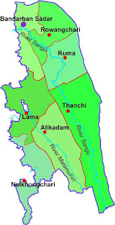
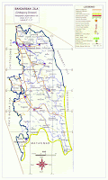
area map
Districts Upazila Map

Name of Upazila
Area (Sq.Km)
Lama
677.00 Sq. Km.
Thanchi
2610.00 Sq. Km.
885.78 Sq. Km.
Ruma
616.42 Sq. Km.
Naikhongchhari
469.00 Sq. Km.
Rowangcchari


Share:

Bandarban DIstricts

Bandarban is a locale of Bangladesh. Bandarban is a piece of the Chittagong Division and Chittagong Hill Tracts of Bangladesh. Bandarban locale is limited by Chittagong, Cox's Bazar and Rangamati Hill Tracts District. 

   district map
     Bandarban District map


Alikadam Upazila, Ruma Upazila, Thanchi Upazila, Naikhongchari Upazila, Rowangchari Upazila), 1 Municipality (Pourashava), 30 Union Parishad and 1482 Villages.

Share:

Sunday, May 21, 2017

Shanti Bahini (Before Story of the Peace Forces)

The Shanti Bahini "Peace Force" was the name of the armed wing of the Parbatya Chattagram Jana Samhati Samiti (United People's Party of the city Hill Tracts) in Asian countryit's considerend associate degree insurgent cluster in the Asian country.The Shanti Bahini was created out of principally members from the Chakma tribe


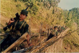
Shanti Bhahini
Shanti Camp
Hill check
Villages Rounds  

the freedom of Bangladesh in 1971, Manabendra Narayan Larma established the Parbatya Chattagram Jana Samhati Samiti (PCJSS) on February 15, 1972, looking to manufacture an association speaking to all the tribal people groups of the Chittagong Hill Tracts. Larma was chosen to the Bangladesh Jatiya Sangsad, the national assembly of Bangladesh as a competitor of the PCJSS in 1973. At the point when Larma's proceeded with endeavors to make the administration perceive the privileges of the tribal people groups through political dialogs had fizzled, Larma and the PCJSS started arranging the Shanti Bahini (Peace Corps), an equipped compel working in the Hill Tracts region. 

It was framed in 1972 and battled for a long time against the administration.Shanti Bahini started assaulting Bangladesh Army guard in 1977. They did the hijacking of regular citizens and coercion. Larma and his revolt drive continued battling Bengali interruption into tribal territories. Being the fundamental pioneer of the PCJSS and the Shanti Bahini, Larma therefore remained in isolation from government security strengths. In any case, factionalism inside the PCJS debilitated Larma's standing and he was killed on November 10, 1983. On 23 June 1981, the Shanti Bahini assaulted a camp of Bangladesh rifles, executing 13 pilgrims. They caught and afterward executed 24 individuals from Bangladesh rifles.In the 1980s the Government of Bangladesh begun to give land to a large number of landless Bengali pilgrims authoritatively. Numerous pilgrims were compelled to move to secure areas in light of the rebellion, surrendering the land they were given and which was then assumed control by tribal groups. On 29 April 1986, Shanti Bahini assaulted Bengali pilgrims and done a slaughter. In the assault, 19 Bengali regular citizens were executed. On 26 June 1989, the Shanti Bahini torched towns where occupants had voted in Bangladeshi decisions. In 1996 Shanti Bahini kidnapped 30 bengali pilgrims and executed them. 
Shanti Camp
Shanti Bahini Forces
forces
Shanti forces


Share:

Chittagong Hill Tracts: Land, individuals and culture -3

The old Rangamati town was submerged under lake water and another town must be assembled later. The lake is brimming with fish and gives offices to cruising, swimming, and skiing. There are additional offices for calculating and short excursion by Sampan - the nearby name for nation vessels. The reaches or slopes of the CHT rise steeply looking significantly more amazing than what their tallness would suggest and stretch out in long restricted edges. The most astounding tops on the northern side are Thangnang, Lang lang, and Khantiang while those on the southern side are Ramu, Taung, Keekradang, Tahjindong - 4632 feet, most noteworthy in Bangladesh - Mowdok Mual, Rang Tlang, and Mowdok Tlang. The valleys of the CHT are secured with thick-planted backwoods. The vegetation is semi-evergreen to tropical evergreen ruled by tall teak trees. The characteristic vegetation can be seen best in the Rain-khyong valleys of the Bandarban area. This area gives profitable wood which is utilized for different purposes, other than providing wood and bamboo for the Karnaphuli Paper Mills and the Rayon Mills arranged at Chandraghona. Here a traveler might be fortunate to perceive how colossal logs of wood are being conveyed to the plain by the subdued elephants. The occupants of the CHT are for the most part tribal and their life is amazingly entrancing. The Greater part of them are Buddhists and the rest are Hindus, Christians, and Animists. In spite of the servitude of religion, components of primitiveness are firmly shown in their ceremonies, customs, and regular daily existence. The tribal families are matriarchal. The ladies people are more persevering than the guys and they are the primary gainful constrain. The primary control of the general population of CHT is agribusiness. 
Share:

Chittagong Hill Tracts: Land, individuals and culture -2

The Chakmas are the biggest ethnic gathering in regard of the populace. The Chakmas have a place with Mongoloid race. They have their own particular dialect and script. The second biggest group in regard of the populace is Marma established basically in Bandarban region. Geographically, the CHT is the main sloping range in Bangladesh. With Ladakh, Sikkim, Bhutan, and Sri Lanka, they constitute one of only a handful few outstanding habitations Buddhism in South Asia. Emphatically untypical of Bangladesh in geology and culture, the CHT have soak wilderness slopes, Buddhist tribal people groups, and moderately low-thickness populace. The locale contains a mass of slopes, gorges, and bluffs secured with thick wilderness, bamboo, creepers and bushes. The CHT is separated into four valleys encompassed by the Feni, Karnaphuli, Sangu (Sankhu) and Matamuhuri waterways and their tributaries. Rangamati, a lavish and verdant provincial region having a place with the Chakma tribe, is interested in guests, as is Kaptai Lake. Well known Kaptai Lake, the biggest "man-made" lake, spreading more than 680 SQ. km. of precious stone clean water flanked by slopes and evergreen woodlands lies in the Rangamati Hill area. The lake was framed when the Karnaphuli waterway dam - 153 feet high, 1800 feet long peak - was worked with the end goal of hydroelectric power extend at Kaptai. The lake, ringed by thick tropical and semi-evergreen backwoods, looks like nothing else in Bangladesh. While the lake itself is delightful, the covered angling towns situated on the lakeshore are what make a visit truly extraordinary. Watercrafts that visit the towns leave from Rangamati. Bring your swimming apparatus since you can take a drive anyplace.
Share:

Chittagong Hill Tracts: Land, individuals and culture -1

Although Bangladesh's populace comprises for the most part of Muslim, Bengali speakers, it additionally contains an assortment of other ethnic gatherings living in the Chittagong Hill Tracts (CHT). The CHT a home around 800,000 tribal individuals shaping 0.5 percent of the aggregate populace of the nation is a standout amongst the most various locales in the nation as far as topography, ethnicity, culture and customs of the general population. From time immemorial the CHT has been the home to eleven indigenous ethnic individuals. They are the Chakma, Marma, Tripura, Tanchangya, Mro, Lushai, Khumi, Chak, Khiyang, Bawm and Pangkhua; moreover, few descendants of Assamese, Gorkha and Santal likewise live there. There are additionally Bengali populaces in CHT in view of government endeavors to resettle the range with Bengali individuals amid the 1980s. The indigenous Jumma individuals are particular and not quite the same as the dominant part Bengali individuals of Bangladesh in regard to ethnicity, culture, customs, race, dialect, legacy, religion, political history and economy. The CHT involve a region of 13,295 square kilometers (5,133 sq mile) in southeastern Bangladesh and fringe India and Myanmar. The tracts are around 60 km (37mile) east of Chittagong. They shaped a solitary locale of Bangladesh until 1984, when they were isolated into three areas: Khagrachari, Rangamati, and Bandarban. The few ethnic gatherings that living space the CHT every one of them has their own particular dialect and culture.

Share:

CHTs

Ethnic gatherings:                                                                                                                                    Chakma, Marma, Tripura, Tanchangya, Mro, Lushai, Khumi, Chak, Khiyang, Bawm, Pangkhua. Alongside, few descendents of Ahamiya, Gorkha and Santal likewise live there. They all in all self-recognize as the Jumma individuals (HighLanders), the main individuals of the CHT.                                                  
Populace: Around 800,000                                                                                                                       City: Rangamati, Khagrachari, and Bandarban                                                                                       Zone: 5,093 sq. miles (13,189 sq. km.) Dialect: Ten indigenous dialects Religion: Buddhist, Hindu, and Christian

Share:

Saturday, May 20, 2017

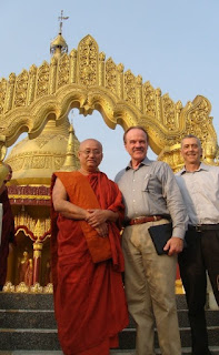
The Buddha Dhatu Jadi (The Chittagong Hill Tracks in Bangladesh)

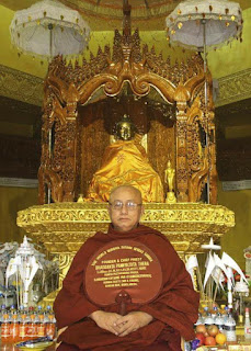
u pannya joto

Van. U pannya Jota Mahathero

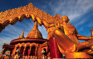
The Buddha Dhatu Jadi is found close Balaghata town, in Bandarban City, in Bangladesh. Dhatu is the material remains of a holy individual, and in this haven, the relics have a place with Buddha. 

Bandarban has a tremendous ethnic people of Buddhists. Buddhism is practiced by a little rate of 0.7 in Bangladesh, dominatingly a Muslim country. Buddhism is the third-greatest religion in Bangladesh and the practice is of Theravada Buddhism; most Buddhists are from the south-eastern area of Chittagong and the Chittagong Hill Tracts.

In Bangladesh, the Theravada Buddhism, now practiced as "Sangharaj Nikaya", was introduced in the late nineteenth century, supplanting an extensive part of the old sorts of Buddhism cleaned till then. The credit for this is given to Ven. Saramedha alluded to broadly as "Sangharaj".

Golden temple

Golden Temple


The ethnic people of the town has a place generally with Marma, an indigenous get-together of the Chittagong slant region on the eastern end of the country. They are of Arakanese dive and Buddhists by religion and are the second-greatest indigenous assembling in the slant territories of Bangladesh.


visit by golden Temple

Visit By Golden Temple


Ven. U Pannya Jota Mahathero is the coordinator and manager pastor of the asylum. He has a place with the magnificent Bohmong gathering of Bandarban. He is a Theravada serve since 1991. He had served the organization of Bangladesh for quite a while as a senior partner judge. The Buddha's dhatu (relic), which is esteemed in the haven, was a gift given to Ven. U Pannya Jota Mahathero in 1994 by the State Sangha Maha Nayaka Committee of Myanmar.

Share:

Friday, May 19, 2017

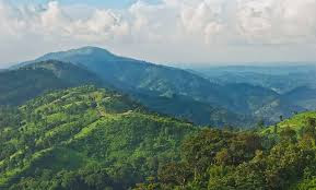
This Hill is Evergreen

bandarban
The Green Hills Bandarban 

There are three hill districts in chittagong . Hill districts are_ Bandarban, rangamati and khagrachari. Hill Districts are very beautiful. In this hill district, people of different nationalities and religious live.Their days are very difficult to cut.They have to collect large high mountains and eat food, there is no better way to travel. They live like helpless people. They live and struggle with life. They don't get any help .There is no chance of better medical Service.

Evergreen
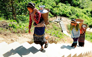
Mountain Girl
Share:

Tuesday, May 16, 2017

Khagrachari Map

District Map
District Map

Khagrachari Map
Khagrachari Map

It’s geographical coordinates are 23° 6’ 0” North,  91° 58’ 0’’ East and it’s original name (WITH  DIACRITICS) is khagrachari

Share:

Sunday, May 14, 2017

Chimbuk hill

Chimbuk hill is the third highest mountain in Bangladesh. Chimbuk is one of the most familiar tourist spot in Bandarban. It is just 26 kilometer away from Bandarban sadar. Chimbuk hill is about 2500 feet high above sea level. The road of this area is zigzag. 
Chimbuk
Chimbuk Hill
So if you ride in a jeep it will be charming. While your jeep is moving through the various indigenous villages, their simplicity in human gestures will compel you to think about our predecessors struggles to cope with to maintain existence. They are as simple as nature. However when you are looking down from Chimbuk, it will get you the feelings of floating over the clouds. When it is a shiny day, you can see the shades of clouds over the hills. The huge horizon of zigzag hills seem waves of a see. You will also see the beauty of Chimbuk and Nilgiri.

Share:

Information for Visitor

Nilachal
Nilachal Mountain Cloud

The tourist spot is under construction. Yet there is no food and accommodation facility. The authority have already erected infrastructures for restaurant and rest house and it will start near future.                                     

So if someone want to stay long there, he should to take food and drinking water from Bandarban town.Nilachal is just 5 kilometer away from Bandarban town. So visitor can hire private jeep or auto rickshaw to go there.

Share:

Very Nice to Nilachal


There is another beautiful place to see near Meghla is called Nilachal also maintained by district administration.                                                                      


                                               Near Nilachal                                                                                                                     

It is known as tiger hill. The view of Nilachal is so spectacular for snapping.


Share:

Recent

Powered by Blogger.

Facebook

https://www.facebook.com/profile.php?id=100017621295729

Share news on LinkedIn | LinkedIn

Share news on LinkedIn | LinkedIn 3 Hill District of Bangladesh By Palash https://www.fiverr.com/bpalash414

Total Visitor

Search This Blog

Search This Blog

Hill District of Bangladesh

Followers

Powered By Blogger

Wold

Wold
map

Recent Post

Blogger Pages

LightBlog

Pages

Adbox

BBC NEWS

Silver